Showing posts with label hikes. Show all posts

Tuesday, November 6, 2012

Chaco Canyon - A visit into the PAST...

It takes perseverance, patience and just a bit of "no pain, no gain" qualities to get you into Chaco Canyon...and it's worth every nerve-racking/body-jolting/expletive-filled moment that it takes to get there. If you are a thrill seeker, these roads are for you! You have two options to get into the canyon.


Fajada  Butte and visitor center
1) From the north you can enter off Hwy 550/44 and eventually hit CR 7950 for 16 miles...and after 13 jaw-jarring washboard miles you will have arrived at the visitor center, or 2) from the South enter from NM Hwy 57 for 20, less body-jolting (according to locals), miles. Either way you will reach the visitor center. (oh, psst - no cell coverage in the park....unless you are in the parking lot).

Cliff dwelling ruins in campground
Gallo Campground is just a mile from there but it is 1st come/1st serve. There is no lodging, gasoline, repair svcs or food in the park and the nearest town is 60 miles away - so come prepared.
 
There are 10 primitive sites to visit, 6 by the paved loop drive and the remaining 4 by hiking trails, not for the faint of heart, (ranging in distance from 3 - 7.4 miles) to visit two of the sites up on the adjoining mesas. Largely due to the immense sizes of the site we covered the park area over several days...using the Trail Guides that are available for a small fee at each site ($.50) or you can borrow and return to be recycled by others.
 
Example of information provided in trail guides


The trail guides not only provided historical facts and information, but artist renderings of layouts of the pueblos, photos of masonry examples, construction of roofs, ceilings and walls, as well as the corresponding & numbered posts-to-text explainations of typical and unique features at each site.
 
 
Occupied A.D. 950-1250s, Chetro Ketl is the 2nd largest pueblo in Chaco. These beams are between the second and third floors of the pueblo. The pueblo covers approx. 3 acres, estimated 500 rooms of which 275 were 2nd/3rd floor rooms. A large portion @ post 1(see map above) of the pueblo is "unexcavated" in an effort to preserve. (We discovered that quite a bit of the ruins are "unexcavated" or were excavated, documented, preserved in some fashion then back-filled to preserve.)


Leading from Chetro to Pueblo Bonito is a short trail along the bluff for petroglyph viewing...a trail guide descibes the 13 in all, it's worth the detour.


At Hunge Pavi pueblo complex, circa A.D. 1000-1250's,  examples of the wood beams used for flooring (left)  and the 3' thick walls of slate/sandstone can be found.


Next on the tour is Pueblo del Arroyo - circa A.D. 850-1100, where portions of the site were built using a block sandstone as seen in the photos below.

even, flat outer walls are evident in all of the buildings


cross section of wall of block sandstone and mud mortar made from the nearby Chaco Wash, which during construction was 8' wide by 18" deep.
"Overgrazing and natural cycles of erosion in the last 100 years has increased the wash to 100' wide and 30-40' deep." (WNPA publications)

Which brings me to the largest and most visited pueblo in the canyon Pueblo Bonito (Spanish for "Beautiful Town"). Pueblo Bonito in it's entirety consisted of 600 rooms, with the oldest section dating CE 850 to the late 900s - that being confined to 100 ground & upper story rooms.

This photo is of the oldest vigas (tree beams) in the pueblo and is protected by a small 20th C roof with drainage eave/pipe.

 
Early looting/scavenging of the ruins can be seen by the neatly sawed remains of exposed beams throughout the sites. **


An example of beams, flat walls and a T-shaped doorway.

This ends photos of the pueblos within this posting, however there is a slide show attached to my blog that displays these and other sites within the park.

The short 2 min video here is one that I took as I went down and into Pueblo Bonito where it is permitted. (My apologies, the first 30 sec I had the camera at the wrong angle and then corrected it.)
The stops within this area descend 14 stairs, stooping through 11 narrow doorways that are 20-27" wide, 41-46 " high - so I want to thank my chiropractor for keeping me limber enough to experience this .... this pueblo is 1000 years old and I got to scamper through it. (** Note: Look for the 'sawed off beams' mentioned above.)


Hope you have enjoyed this trek through the past...I know I did.


~Ciao

Tuesday, October 30, 2012

Fred and Barney didn't dwell in these historical ruins....


Anasazi Heritage Center-Dolores, CO

Near Cortez, CO is one of the most interesting and beautifully curated visitor centers, Anasazi Heritage Center, that we have encountered on exploring our "bucket list" of national parks. A mere 3 miles outside of Dolores and 10 miles from Cortez this center was educational, interesting, visually gratifying and was filled with artifacts that have been excavated from the nearby Canyons of the Ancients sites.


Overlay of Anasazi cultures in the area

Displays of pottery by the period created, hands on educational displays, and even a replica of a pueblo and kiva that is accessible for close up viewing.
Educational drawers
Anasazi pottery 900-1150 A.D.


Sand Canyon site map

 
According to the information panels scattered around,Sand Canyon Pueblo consisted of 420 rooms, 100 kivas and 14 towers, in 13 room block. A community of several hundred people lived here between A.D. 1245 - 1290, and is twice as large Cliff Palace at Mesa Verde NP.  Excavation of the pueblo community was done between 1983 - 1993 and then re-buried to preserve the ruins.
 
Our day continued as we moved on to Painted Hand Pueblo....
 
        
 We ended our day at Hovenweep National Monument....stunningly beautiful, easy 2 mile stroll of the rim loop that captures both cliff dwelling and pueblo houses...well their remains at least.
 
 
Hovenweep National Monument & Visitor Center

Visiting during October can be risky at this elevation we lucked out with clear sunny skies and a brisk mid 40's afternoon.  Although the ranger informed us that the loop was 1.5 hours, we managed to see all of it in roughly 60 minutes, which included descending to and crossing the canyon floor.


The trail map below gives you an idea of where the buildings were located along the canyon rim.


If you are in Cortez you can see these and a few others that we didn't get to this trip. It certainly was worth the drive.  (I have included a separate slideshow on the right side of my blog with additional pictures of all three sites.)

~ Ciao

Tuesday, February 7, 2012

Baja Adventure - Part TRES - MUCHOS Beach Activities

getting up early to watch the sun rise and have coffee never got boring.....however,
on several occasions during our weeks of preparation to travel down Baja we discussed what we would do with our time while parked on the beach. We are not beach people...you know - the people who go to a beach, spread their towels, lather on the sun screen (or not) and lay down to bake. There is nothing wrong with this activity...however, our days of rving are filled with museums, hikes, national parks, historical buildings and the local history of whatever village, town or city we might be touring. Boy, were we pleasantly surprised! In addition to just sitting and reading a good novel, walking leisurely through the surf and interacting with the many beach vendors we discovered much, much more to the fine art of boondocking on the beach in a foreign country....

Our first day in town we attended an art
show to benefit the volunteer animal clinic
Patron of Animal Welfare.

These panels are actually cement slabs/tables/benches/counter-tops with cut glass designs embedded.


SeaKelp baskets <

Weekly art classes are available
for those who want to learn a new craft...
led by artisans that winter here as well.

                              Sea-grass basket weaving >
Gourds

In addition to the arts - other activities included:
 Geocaching/hiking
 Fishing
Kayaking
Paddle-boarding

bird watching....includes pelicans (shown), blue-footed boobies, egrets, herons, vultures, gulls and hummingbirds, ravens and assorted songbirds.


Baja has many beautiful and ancient Spanish missions....scattered throughout the countryside. Day trips to see Mission San Javier, Mision de Loreto Concho, or Mission Santa Rosalia de Mulege .


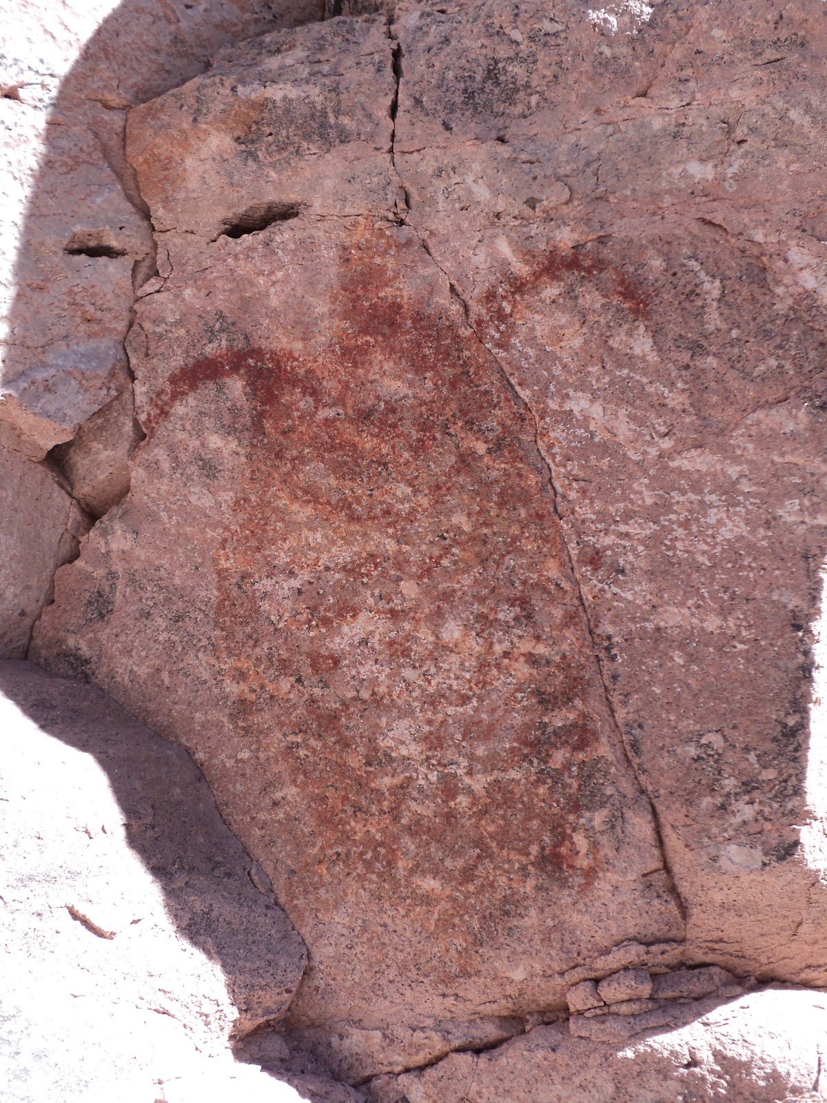
Other day trips to view pictographs near Mulege and Loreto were also on the calendar....


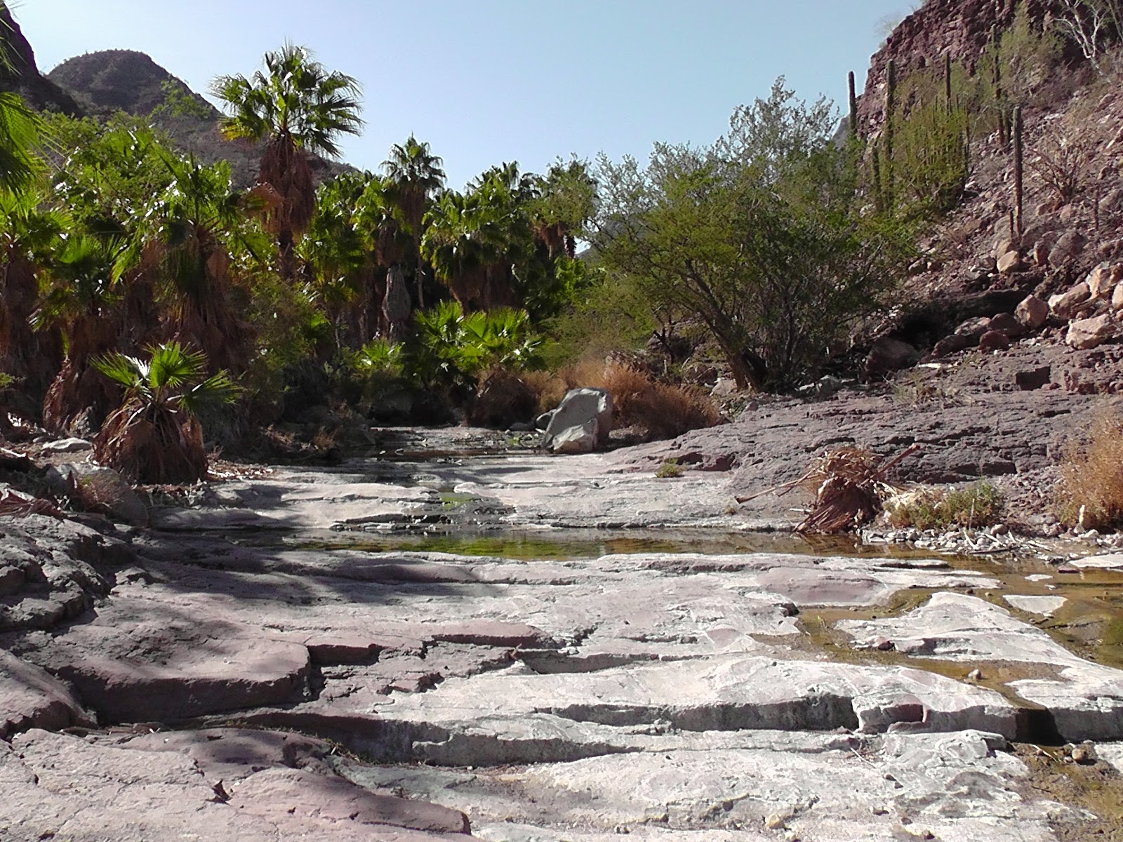
and drives down arroyos found us viewing trees


or to discover an oasis along the way.....


and when all else fails....deciding to learn now to cook in a solar/sun oven - not that I did.
 But one does have the time to learn if so inclined.

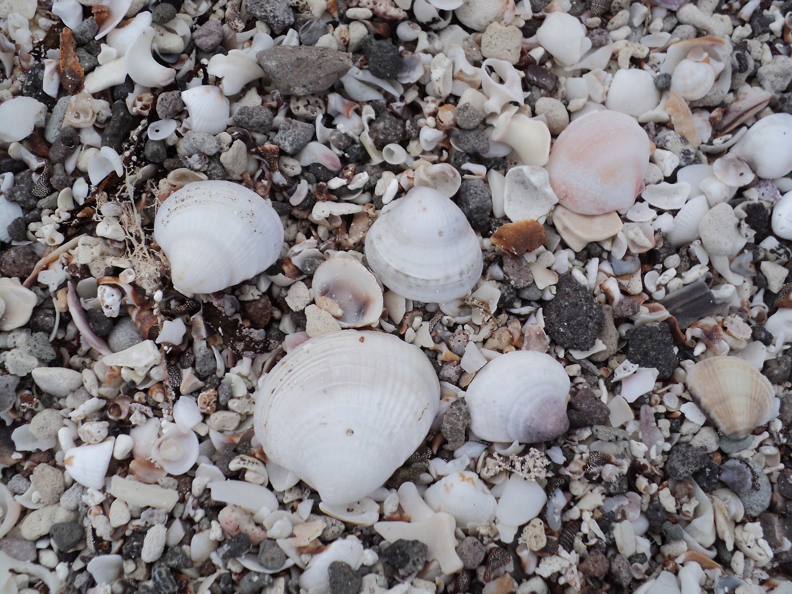
or looking for and collecting shells...


We discovered a variety of activities that filled the hours between sunrise and sunset and still managed to lather ourselves with sun-screen....


~ Adios amigos~

Saturday, November 26, 2011

dry camping outside Ajo, AZ

AJO, Spanish for garlic

We just spent 5 days in the desert just south of Ajo (ah-ho), Arizona - near the old cooper mine. About a 2 miles outside of the town city limits we made a hard right turn and head out into the desert. It is covered with saguaro, dust and the occasional coyote. One can see the environmental damage for miles...the "tailings" or debris fields (no mineral value) are piled 200-300 feet into the air and roughly 2 miles in diameter around the open pit. Frankly, it just made me sad...and a bit angry.
They do have a mine museum with knowledgeable local volunteers who were eager to provide with information and a tour.


There were a few other Rv'ers dry camping, however no one close enough to be considered even neighbors. The fighter jets from Yuma's air base were far noisier and more than evident than humans on the ground. Although we did see evidence of immigrant trails and bushes marked with green tape used as a guide in the dark....it was beautiful, quiet and warm. 

We had a really great time hiking in the desert and enjoying the quiet...and it's close enough to civilization to enjoy as well...so we ventured into town.
Indian community
exican community

Ajo, back when the mine was operational, had a community built on the Mexican and an Indian cultures inside the town..until the residences were leveled when the mine closed back in the early 1980's. The murals above were completed and dedicated earlier this year by the artisans in residence at the Curley School.  There are black and white historical panels to the left and right of these 2 colored murals.
Artist apartments now occupy what was the Curley School. Around back is an Art Galley, Gift and Print Shop.   From November 26 - December 29th there is a gallery show "HOLIDAY HOOPLA" with art, jewelry, pottery and other mediums for sale.
We had the best paninis to date at a newly renovated restaurant on the south edge of town.

We all had paninis so we can't vouch for either the burgers or the beer....but the place was clean, busy and wait staff was spot on.

Restrooms well marked                                           Tile mural depicts the exterior nicely..    
know your gender to use  restroom
tile mural of restaurant
Book and antique store
The bookstore was a pleasant surprise....it carried an array of new and used books, office supplies and connected via a interior door - the antique store with a large collection of $.25 cent books...honor system was the paying system when no one was on hand.

~Ciao


Friday, November 11, 2011

To Yuma-through snow, Zion & Valley of Fire


What a journey we had to YUMA this week. We awoke to snow in Bryce Canyon. ..SNOW???  We couldn’t get our RV travel-ready fast enough, when we pulled out it was 22 degrees…just the day before we had admired the beautiful snow capped hoodoo photographs  we viewed in the Visitors Center…and my request that it would really be terrific to see the snow covered canyon would be “awesome” was really said in jest!
Red Canyon arch as we depart for Zion. Pretty isn't it...the last days of October and we were expecting an Indian summer. However, I am thrilled we got to see the scenery decked out in snow!

Next stop - Zion National Park and some hiking. Soon discovered Angels Landing is (not for the faint of heart) considered 'strenous' we got to Scouts Landing, had lunch and decided to fore go the last .05 miles pulling ourselves up by cables along the narrow ledge.  Walter’s Wiggles (23 switchbacks) was challenging enough and the view was spectacular!


This trail leads you to Scout & Angel
Landings....3.1mi to the top of Angel's Landing. At 2.6 mi you reach Scout's Landing where lunch and a respite. We did not use the cables to pull ourselves up the last .05 miles, along the very narrow, and in some places missing trail to the top. The view from our vantage point was just fine...

Angel's Landing is on the other side of that tree sticking up on the right side (middle portion of photo).....the 3-sectioned pipe fence is the only barrier between you and a 1200' drop straight down.


Chipmunks are friendly and not afraid....they check out everything, including your physical space.

We arrived with no reservations in the full-service campground, however we did have a spot each of the 4 nights we were in Zion...even the hassle of moving every day could not spoil the beauty and splendor that is Zion.

We did take the Emerald Pools hike although the pools were more mud-like this late in the season. I have included a short video of the waterfall that feeds the pools. Enjoy....


Valley of Fire State Park located (approx) between Bryce and Las Vegas afforded us the opportunity to see different formations of red rock up close and have lunch in the shade of a gigantic rock.
Lone Rock picnic area


Indian lore, interpretive programs and self-guided tours provide for activities young and old alike.